Site Resources & Tools


Dive planning for Bellingham Marine Park
Site Briefing

By Contributor (Reviewed 06/19/26)
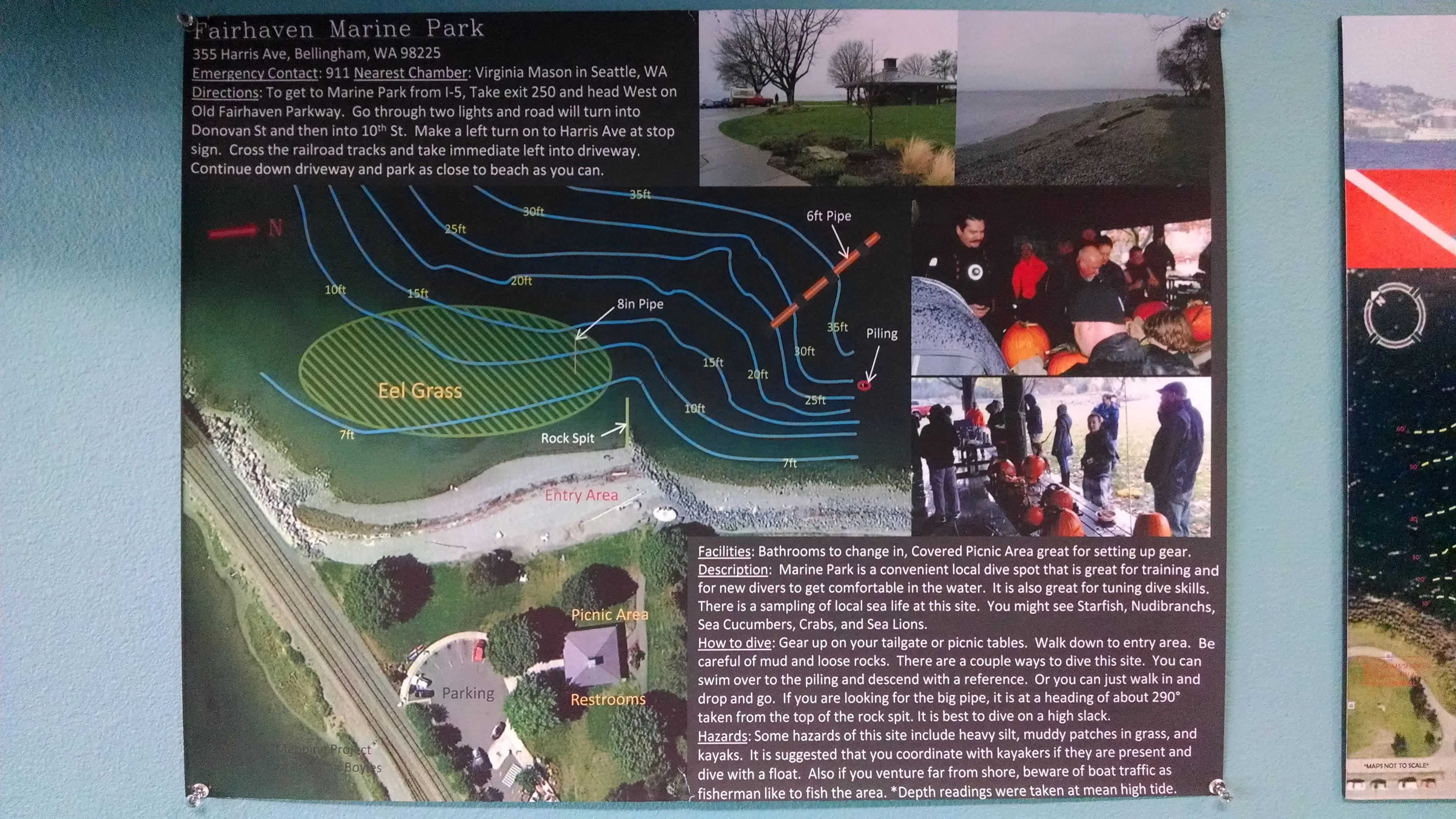
There's never any current, but the viz is typically terrible. There's often some life to see in the vicinity of the piling that sticks out of the water in the north end of the park. If you proceed due SW from there you'll intercept a big stormwater pipe around 25'-30' that comes out of the substrate at 20' and runs WNW out to 50'. Most of the life in the park is on and around this pipe, especially the concrete blocks that support it every 50' or so.
See the map in the photo section
⚠️ Before diving at Bellingham Marine Park, always check the site-specific wind/wave forecast, tide/currents, and recent reports (latest: Jun 16, 2026) !
Nearby Stations
7/8/26
NOAA Current XTide Current NOAA Tides Bellingham Marine Park
Click a pin to see current, tide, camera, or buoy data near the dive site (you may need to zoom in or out)
Nearest Featured Sites
- Strawberry Island West Side (~15 miles)
- Skyline (~18 miles)
Nearby Sites
- Boulevard Park (~1 miles)
- Glass Beach (~2 miles)
- Larrabee State Park (~5 miles)